Want to unlock insights into how accessible a location is and who the people are around it? Catchment analysis might just hold the key.
What is catchment analysis?
Catchment analysis is a way of using spatial data to understand accessibility within a given radius to a specific location based on a travel time or a simple radius. This catchment can then be used to look into the demography of the population within a given area. Because it can offer insights into who lives and works around a particular location, how many people can access it and the modes by which they can do so, a catchment analysis is a powerful investigative tool for a wide range of planners, related professionals and their unique types of projects.
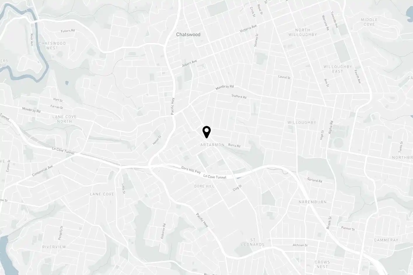
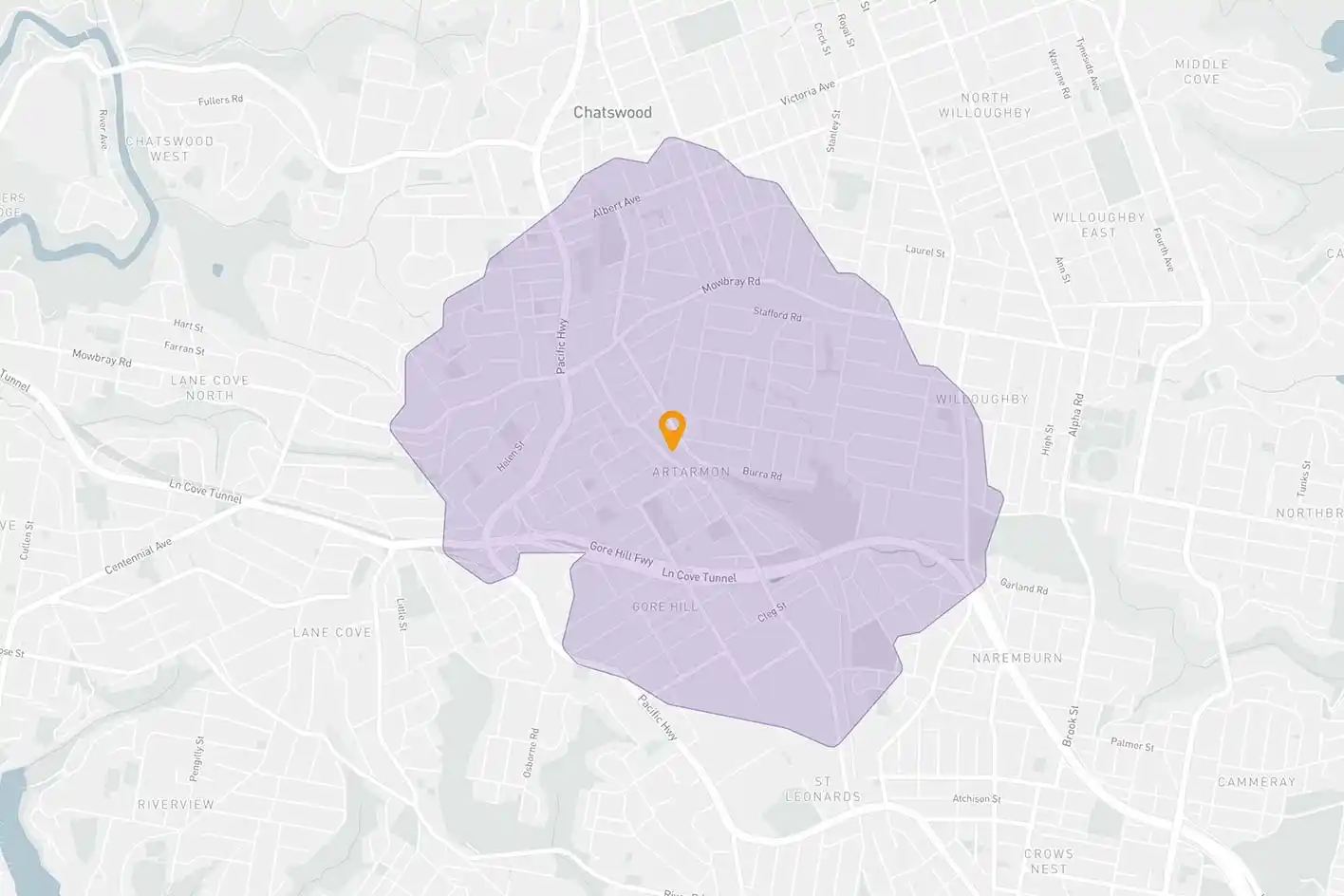
This analysis depicts a 20-minute walking catchment from a train station in Chatswood, NSW.
1. Find gaps
Proximity to a location – whether that’s by distance or time – can be a helpful predictor of visitation. Moreover, if you understand how far visitors are likely to travel to reach your chosen destination, you can define its catchment area and better estimate its visitation potential.
With this information, it’s possible to map out entire networks and the catchment areas for each individual location. Then, by using catchment areas visualised on a map, it’s easy to identify where your locations’ catchments – whether it’s a new quick service restaurant, a public sporting field or otherwise – has overlaps or concerning gaps. Insights like these can be instrumental in guiding both short and long-term growth and development strategies.
Catchment analysis can hold powerful spatial insights for both the public and private sectors.
2. Understand demographics
Once you have defined a catchment area, you can extend your analysis to ask the question: who are the people within those boundaries? To answer this, you can combine a defined catchment area with other spatial datasets (like Census data) to help you attain a deeper understanding of the people within an area.
With demographic data such as gender breakdown, population growth, income, age, occupation and industry, a number of public and private sector planners can make better decisions and assess the catchments of existing locations in greater depth.
Examples of this include:
As part of their site selection process, a network planner for a quick service restaurant chain can compare the demographics of potential store trade catchment areas
A government social planning team can identify demographic trends in their community and compare them with the wider population
Get in touch to find out what Planwisely can do for you
There’s often a strong correlation between accessibility and visitation, which means understanding how accessible a location is can offer real insight into its visitation potential. Accessibility insights are particularly important when planning new locations; for instance, knowing how many people can reach a potential location (such as a train station, a park, a public swimming pool, a retailer) in a 15-minute walk or ride can guide your analysis and clarify your selection process. Plus, because these insights can be used as an indicator of visitation potential, they can be used to assess how existing locations are currently performing, too.
Catchment analysis tools often allow users to define the size of their catchment to customise their analysis. Within Planwisely, for example, users can select a location and then refine their catchment by time taken to reach the location, distance from it or even mode taken to get there (by walking, cycling, public transport or car). This level of customisation makes catchment analyses exceptionally useful for a variety of geospatial projects.
A gap analysis of your own or your competitors' networks can quickly help you identify insightful trends and strategise for the future.
4. Identify competitors
The flexibility of a catchment analysis means that its power to define and measure can be used to assess your competitors, too. This is highly relevant in site selection and network planning, particularly in businesses where network coverage and market share advantages are fiercely fought over.
Mapping a competitor’s store network, overlapping it withyours and running a catchment analysis for those locations will allow you toget an understanding of their strategy, see how your network stacks up andidentify gaps that you can fill. This ability to investigate similar or competitorlocations using catchment analysis tools can also be useful in a range of otherprivate and public sector settings, too.